 |
| Site location map. Click to enlarge. |
Although it was getting late in the dry season for trips into the ponderosa pine belt, Rod Crawford and I decided to make one last foray. Our destination was the Ruby Creek watershed in Chelan County. In retrospect, we should have selected a higher elevation site; after a solid day's work, we had collected only 17 or 18 species. The habitats were just too dried out. And unlike in recent weeks, my cone samples didn't contribute even one species to the site list this time. However, I was able to take three full cone samples and one partial one. Each of them contributes to our knowledge of which spider families use the fallen cone microhabitat during the dry season. Data points aren't always individually flashy, but together they do paint a picture. Or so we hope.
Northwest End of Tronsen Ridge
 |
Fallen Doug-fir cones on
ridgetop roadside |
 |
Fallen ponderosa cones
under ceanothus shrub |
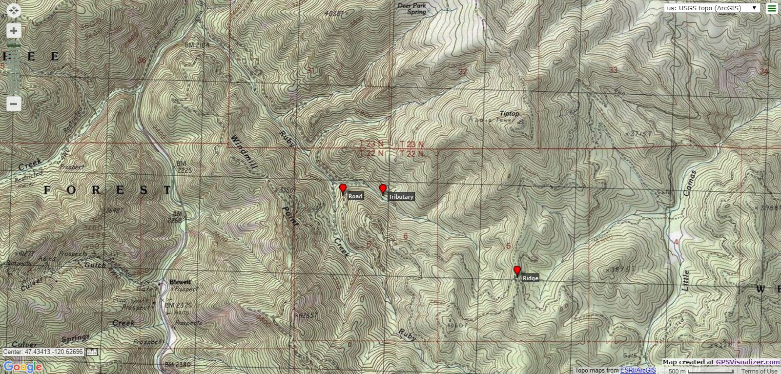
Our first stop was on the ridge separating the Ruby Creek and Little Camas Creek watersheds, elevation about 3,660 feet. This little ridge is itself part of the larger Tronsen Ridge. Tronsen Ridge in turn is part of the Wenatchee Mountains, the range in the Cascades that separates the Yakima River and Wenatchee River watersheds.
 |
The introduced sulphur cinquefoil
(Potentilla recta) was in full bloom |
 |
Sleepy Parabagrotis moth
tapped from a cone |
I tapped a full set of 50 Douglas-fir (
Pseudotsuga menziesii) cones here as well as a partial set of 25 ponderosa pine (
Pinus ponderosa) cones. The Doug-fir cones were easily accessible roadside cones. The ponderosa cones required a little hill scrambling and then burrowing under a redstem ceanothus (
Ceanothus sanguineus) that encircled my cone source. I collected 7 juvenile spiders from the Doug-fir cones and 3 juveniles from the ponderosa cones. The families represented were typical for this microhabitat: Amaurobiidae, Anyphaenidae, Gnaphosidae, Linyphiidae, Pimoidae and Thomisidae.
Ruby Creek
 |
Looking uphill to source of
roadside ponderosa cones |
 |
The lush surroundings that the closed
road cones rolled into |
We made our second stop where the forest road crosses a tributary of Ruby Creek. I tapped two full sets of 50 ponderosa cones nearby, both at elevations of about 2,660 feet. Both sets of cones had accumulated where steep hills met a roadside ditch. I found one set along the main forest road, where it was fully exposed to the sun. The other set was along a shady, closed forest road that was quickly being overtaken by bigleaf maple (
Acer macrophyllum).
 |
Rod the Rock Chucker making the
road surface safe for my city car |
I collected 2 juvenile spiders from the "sunny" set and 6 from the "shady" set. The families represented in these samples (Agelenidae, Araneidae, Clubionidae, Linyphiidae, and Lycosidae) were again typical, for the most part. I rarely tap araneids from fallen cones, but it has happened before. The absence of theridiids from all of the day's samples was unusual since the family Theridiidae
accounts for 23% of spiders tapped from fallen cones in eastern Washington. However, like the odd araneid in a cone tapping sample, an absence of theridiids has happened before.
 |
| A Lorquin's Admiral (Limenitis lorquini) sipping salts from Rod's pack. |


No comments:
Post a Comment